Showing posts with label Mineral King. Show all posts

Monday, August 5, 2013

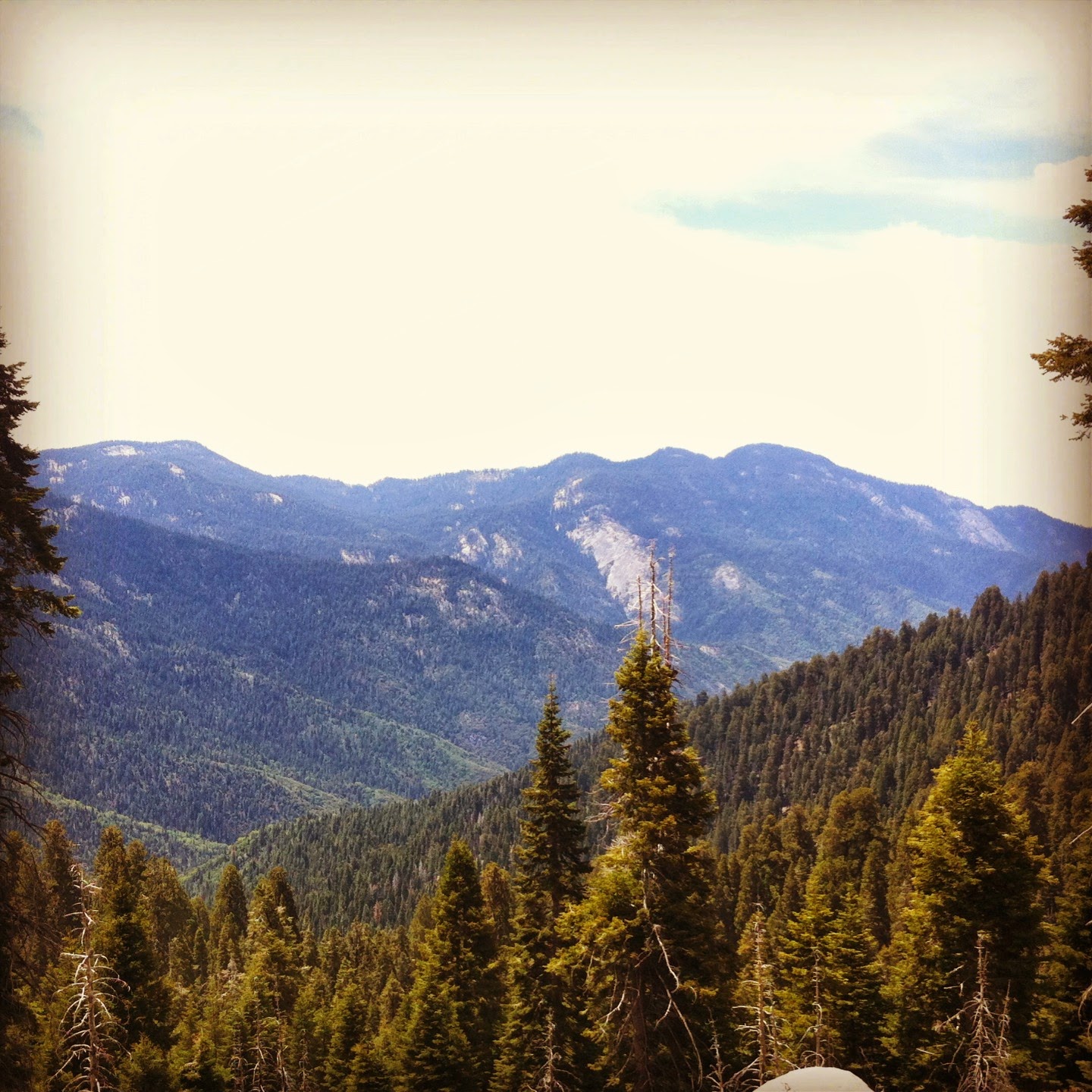
Why do we always return to Mineral King? Because....THIS:

The mission for this particular trip was to finish our previous goal: Summit Sawtooth Peak. Yes, we went over the pass (11,730 ft) on our last trip, but we had yet to make it all the way to the peak (12,343 ft). Since we were only weeks away from attempting a Mt Whitney summit, this trip was a defining moment (in my head). 
We headed up to Mineral King Friday after work, planning our usual (car camping) overnight at Cold Springs. This is one of the few places you can car camp and feel like you're not on top of your neighbors. The camping is first come first serve, and only costs $12. Not many people are willing to drive the 25 mile winding one lane half paved road to get there (we've timed it many times, even if you know the road well, it takes an hour and half). We weren't doing any backpacking so we didn't need to pick up a permit (day hikes do not require permits). 

We woke up casually (probably around 6am), and headed out. The trail is steep at first, then splits with the Timber Gap trail (we've done that one plenty of times, love it!). The next 3 miles (or so) are a gentle climb and we were able to get up fairly fast. Looking up before you head into the Monarch Lake area, you can see Sawtooth peeking out:


The trail passes through a forest-like area before you head into the rocky Monarch Lakes area. You can see the trail ahead of us, and how gentle the climb is. Note the little point that is Sawtooth in the upper right:


As always, the deer around here show no fear of humans:


Once you pass by the Beautiful Monarch Lakes, you immediately start to make your way up the sandy slog of Sawtooth toward the pass. I tried to capture how steep it is:

Looking down:


As we climbed higher (stoping every 3 minutes to catch our breathe and give our legs a rest), Upper Monarch Lake becomes visible. This is a great lake to take a swim in btw. 

As we got higher and higher, I couldn't help photograph this mountain peak to the left a million times. The beauty of this place really is incredible (It also gives a feel for the steepness of the mountains around here).


 This is the view looking over to the peak from the Pass:

It's about a mile or so rock scramble from here to there...and we were goin' for it. We had been warned by others and even the rangers that there isn't a clearly marked path, but that it was "easier" than the part from Monarch Lake to the Pass...
This was about halfway to the point...see if you can spot Sam:

Not too long after I took this photo, I sat down for a break. I suddenly felt like I needed to lay down and go to sleep. Oh no...that's not good. The altitude was hitting me hard, and since we were having a hard time following the trail (basically just climbing rocks and aiming for that big pointy thing), we opted to abort the mission. One problem: there is no "trail" to turn around on and head back. Me, being a genius and clearly an outdoor expert (HAH!), said "hey look, lets follow those footsteps, straight down to the lakes..."

 Big Mistake. We resorted to sliding down on our butts, with the occasional slides not knowing when/how they would end, nearly falling off several cliffs, and both thinking "This is how we die....I've always wondered how I would go..." Tears were shed (my tears, Sam is a robot), prayers were said, and we just kept going, keeping those lakes in view. We had lost all direction/trail/common sense. For some reason we just kept going down. Looking back up I tried to take one photo of where we had slid down on our butts:

It looks like a cliff, because it is...and several times we would hit loose sand covering a rock and just keep sliding. We were SO dumb. What seemed like hours passed as we continued down. I'm sure it was closer to one hour in real time...

Spoiler alert: we obviously made it down because I am writing this blog. I wanted to HUG AND KISS Monarch Lake when we reached it..is it possible to hug and kiss water? 

There was another group of day hikers at the lake swimming, and we ran over to the lake and dipped our water bottles in and chugged water...there was also some shedding of clothes as we jumped in for a swim. They were looking at us like aliens. I'm sure I was crying (yeah, I do that a lot).  We finally spoke, and all we said was something to the effect of "That's not the way you're supposed to get down that mountain, and we almost just died," half laughing, half crying. They couldn't tell if we were joking or not. Their biggest concern was us drinking the water straight from the lake. We had to sit there and mentally recover for an hour or so before we could make it all the way back to the car. 

As we headed down, I kept looking back at Sawtooth, seeing where we had come from, and trying to decide if we were friends or not. 


We learned our lesson, Sawtooth, you win. I will never try to stand on top of your stupid pointy peak at 12,434 ft in the air and see 360 degrees all around me ever again....or will I?


"Nice try, rookie," laughs Sawtooth as he shrinks in the background.  

Tuesday, July 9, 2013

Ahhh....Mineral King Valley: my personal favorite place to go in the Sequoia's. It's not that I don't like Fourth of July. I just don't understand the whole White-Trash-themed BBQ's and sitting around outside when its blazing suns and getting sunburned and drunk. Does that make me Anti-American? Oh well...we did this instead:


Let me set the scene a little for you so you understand just how difficult this 3 day (roughly 30 miles) backpacking trip was. Sam and I have always been campers, adventurers, and outdoorsy folks. It wasn't until this last year that we discovered I struggle (pretty badly) with altitude sickness. That means that when I go up into high altitudes I get sick: headaches, nausea, inability to sleep well, lack of appetite, etc. The first TWO times it happened (read about it here and here), I hadn't even heard of it, nor was I ready to admit I had this 'thing' that clearly only 'unhealthy people who are uncomfortable outside' have. It wasn't until we went to a seminar in search of tips on how to be a successful Mt Whitney Peakbagger that the dots connected. Actually, I think I was sill in denial then. The man giving the talk started listing the symptoms. In my head I was thinking "check, check, yup, check check..." Out loud I said, "No, remember, it was food poisoning...or nerves...or something."

Fast forward to this last trip in the Mineral King area of the Sequoia's. I had read up on my "sickness" and was coming well prepared. I even got some crazy drugs from the doctor (who warned me of the tingle feeling I would get in my hands and feet and the crappy taste in my mouth I would have when drinking carbonated drinks). We had 2 days to acclimate. We spent one night around 6,000ft at a car camping spot, did a day hike to well over 10,000ft, and the next night at 7,800ft...and then we were off....

...to sit in the car while I cried and tried to force a granola bar down and decide if I wanted to make myself go on this trip. All I could think was how much smaller the world felt at that moment. All the places I wouldn't be able to go, the mountains I wouldn't be able to climb...I thought for sure I had mentally prepared myself to "ignore" my symptoms. I thought I could will myself into being fine. Clearly, I had low will power, or I really did suffer from this 'thing'. The previous times I had gotten these symtoms began to make much more sense...and I think we had resorted to turn around and go home.

But I'm stubborn. And though he would never say it or make me feel bad about it, I didn't want to let Sam down. So, off we went....slowly....

We set out to do a loop we had previously turned around on (because I had food poisoning, remember?! ;). Here's a highlighted Map of the route we chose:

Our first night's destination: Bug Pond...er, I mean, Pinto Lake. Beautiful marshy lake area, infested with mosquitoes and Deer. At least it was so the last time we were here. Probably due to it being a dry year, the mozzies weren't too much of a bother. And guess what, I was feeling ok. Not tip top, but I had made it up over Timber Gap (up 1,500ft) , down (2,5300 ft) into the valley, Crossed Cliff Creek without falling into it, and up (1,700ft) again to Pinto Lake.


Crossing Cliff Creek


Home for the Night at Pinto Lake Campground


Sam, cooking dinner with the ultra lightweight cook system he made 


We hiked over to a little hill to catch the sunset reflecting off what we thought to be Sawtooth Peak

The next morning we had to get over Black Rock Pass (3,000ft), pass through the Big Five Lakes Area, the Little Five lakes area, and get to at least the Lost Creek Trail Junction (sleeping somewhere just below 10,000ft elevation). We had been to the top of Black Rock Pass before, but I was barfing. I was looking forward to a barfless summit. Success. I was even eating real food on the way up. 
Looking back toward Pinto Lake as we get closer to Black Rock Pass


Soon, We'll be far above that waterfall


Here's another view of the same waterfall


As you climb black Rock, multiple lakes and waterfalls become visible. It helps you track your progress. 


At the top of Black Rock Pass, looking down at the Little Five Lakes


Getting closer to the Lakes as we go down


And here....We didn't go for a swim though. They were extremely cold and we were not that hot. 


We camped somewhere along the Lost Canyon Trail with the advice from a Ranger. We suspect it was about a mile after the trail junction. The next day was the bi day we were going to climb over Sawtooth. We woke up pretty early, on got on the trail by about 6 am. That may sound terrible, but really, when you go to bed at 9pm the night before, your eyes just spring open at sunrise sometime around 5 or 5:30am. 
Heading out of Lost Canyon, Sawtooth in front of us


Looking back at Lost Canyon. It sure was beautiful. 


Shadow Selfie in Lost Canyon. 


Columbine Lake, halfway to Sawtooth. The hardest part is coming...


Oh look how much Columbine Lake shrank once we got to the top of Sawtooth!


Looking down into Mineral King Valley from Sawtooth Pass. 


We opted not to make the optional summit from the Pass to the Peak. It was another Mile (unmarked rock scrambling) and another 900-1,000ft or so. I did NOT have it in me. I shed tears of joy on this pass. I felt like crap, I had only eaten some nuts and a fruit bar for the day, and I barely made it to the top. But I felt like I had won a war against the altitude. This whole trip will always be one that stands out in my mind as one of conquest, even if just barely. I wish I had taken more pictures to show how steep Sawtooth was on both sides, but it was the last thing on my mind. 
From Left to Right: Nerd 1 (also known as Sam), Nerd 2 (Also known as Katy, me), and Sawtooth Peak. 


Hey Look, We're almost back to our tarp covered car! 


Mineral King, I hope we share more weekends in the future. 
My Favorite picture from the weekend.  I mean...look at it!!!!


Tuesday, June 4, 2013

Here we are again, in Mineral King. This was a short trip. The last time we were here this time of the year it was dumping snow on us.  So we opted for a shorter trip, at slightly lower elevations. Since it was Memorial Day weekend, the reservations had been made several months in advance. As long as we were outside, it was sure to be a great time. This was going to be the first "training hike" for a hike up Mt. Whitey later this summer. 

We got to Cold Springs Campground in the evening and took a short walk through the Birch Tree forest. 

From the campground that night, you could see Sawtooth peeking out, as always, taunting us. 


The next morning we picked up our permit and headed to the trailhead. Today's hike would be about 10-12 miles, depending on how we feel: Starting at 6,500ft, climbing up to 8,400ft, then going down, down, down, through wayyyy too many overgrown spikey bushes....and some more down, to about 5,000ft or so to cross Cliff Creek. It was moving fairly quickly, but we managed to cross without falling in.
Look at that small pack! :)


We met two guys that had packs on the size of me, and neither had poles. One guy had on giant hiking boots, a cotton shirt, and was even wearing jeans (perhaps it was his first time backpacking?)! He looked MISERABLE. The other guy was carrying a large load, but he claimed to be an ex-marine who was "used to carrying" a heavy pack. The miserable guy asked, "How do you have such small packs???"We shared as much information as we could in 5 minutes. We mentioned things like a cook system made of cans, not bringing extra stuff like a change of clothes, or books, etc. I could see an extra pair of sneakers on his bag and a massive sleeping bag tied to the outside. I pointed those out and he got slightly defensive. Then they started bragging about the red meat they brought for dinner...it was useless trying to explain the concept of "what can you go without" to these guys. Clearly, it was his first time backpacking...and unfortunately, he looked like he might want it to be his last (if I were carrying 60 lbs I would have wanted it to be my last also). On (and up from here) we went...

Somewhere along the trail we came to a window in the trees and we could see across the valley...


We made camp somewhere near Bearpaw Meadow (7,200ft) right next to a river (not sure which one and I don't have my map handy). It quickly became one of my favorite spots we have camped so far. Falling asleep next to the sounds of the rushing river is so soothing. For some reason I can't find a picture of the river, just trust me that it's there behind me...

We got a little visitor that night. We had seen him earlier on the trail. He came back in the morning too. He seemed as annoyed at us as we were at him for not leaving the area. We had a little bit of a stare down. The ranger had warned us the bears were being frisky this year because of the low water/low foliage effect. 

Those guys were supposedly going to be coming down the same trail, but we never saw them again. I wasn't feeling too good that night, and we decided for sure that I was a victim of altitude sickness. This would be the third trip that I have gotten sick on, and it's too coincidental to ignore. I'll spare the details, but it wasn't a fun night. 

The original plan was to stay 2 nights, leaving our gear and just wondering around the next day, but instead we hiked out in the morning over Timber Gap (a different route than expected, that's why you always carry a map!). Mileage wise, we did the same, we just didn't stay two nights (And we weren't really stoked about going back the way we came because of the overgrown spikey bush patches that were hard to cross getting down into this valley). 

We had been up over Timber Gap before and were familiar with it. It's a hard hike, but it's beautiful when you get the top out of the grove and feast your eyes on Mineral King Valley...


A successful trip, even if short. I've been reading all about this altitude sickness stuff, and things you can do to try and help it. This summer will be a trial and error process to get my body used to high altitude...especially if we want to hike Whintey in August. Let the experimenting and training begin...


Want to go farther, explore more, and be more comfortable? Go lightweight. 

Monday, June 18, 2012


Ok Snow, you were not in the forecast for this trip, so please don't surprise us! We came back to Mineral King this weekend to do the trip we set out for a few weeks back (but snow happened).

This trip was a planned 30 something mile loop in Mineral King: Over Timber Gap to Pinto Lake, Over Black Rock Pass to Little Five Lakes, and through Lost Canyon to the Top of Sawtooth Pass and out.

We drove from Los Angeles to the ranger station for our permit, and were on the trail by 1pm.
We stopped for lunch at a place we affectionately named "Marmot Rock," because it was covered in Marmot poop (those responsible were present, but we did not share our lunch with them).
Look at the view of Mineral King Valley already!

The climb out of Mineral King toward Timber Gap is quick and steep (1,600ft of elevation gain in about 2 miles).


But when you turn around and look back, its totally worth it!

Once over Timber gap, we had to go down nearly 2,300 feet through the buggiest (but prettiest) marshy field of wildflowers where water was still running off from the now that year. I snagged a few photos of the interesting flowers, but we were being assaulted by swarms of mozzies and had to keep going fast.  


Crossing Cliff creek was relatively easy because of some rock damns. I'm not sure why my backpack looks so big in this picture. 
There's a nice camp spot right after you cross Cliff Creek, complete with some loitering deer:

...but we were headed to Pinto Lake: 2.9 miles to go and 1,700 feet to climb. 

We didn't take any photos of Pinto Lake or the area where we camped for the night. The sun was going down and we had to make dinner quick. We had lingered a little too long at Cliff creek earlier, and that last 1,700 foot climb was harder than we expected. And this is where the fun part of the story comes in...

We had this genius idea of bringing chicken sausages to eat for dinner. They're small, and you can roast them on a fire on a stick. (Side Note: We found out later there are NO FIRES allowed at Pinto Lake--we claim ignorance b/c there was an existing fire ring and it was below the elevation that fires are normally allowed. They just don't allow it here b/c its a heavy use area). So we thought we were so clever, bringing this little treat with us (as the rest of the meals would be dehydrated meals and bars). They were frozen when we left the house and put them in the ice chest for the drive. We put them in our backpack at the last minute next to a cold water bottle. I think we were thinking it would take a few hours for them to defrost, and it would coincide with the time we would be roasting them. Well, we're dumb...and they were not even really cold by the time it was dinner. For some reason, we roasted them up and ate them anyway (funky smell and all). Sam quit a few bites earlier than I...and off to bed we went, with our tummies angry at our choice. About an hour later, I had to come out of the tent....I'll spare you details (Side Note: In the pitch black of the night in the middle of the wilderness, a deer walking by 5 feet from you while you're trying to do your business is horrifying). 

The night crawled by. I definitely felt like I had a fever. Add that to the other symptoms and it seemed to equal food poisoning. Sam said he felt his heart racing fast, but he ended falling asleep with little problems. We joke that he could eat a bomb and probably be ok. I'm the sensitive stomached one. The morning wasn't happy to see me either. I tried to eat some oatmeal...it didn't want to stay in me (Note: 2 years later I still WONT eat oatmeal on the trail). We tried to decide if I was well enough to push through or if we should turn around. Well, we're dumb. So we kept going. I really wanted to see what lay ahead of me, and on the other side of Black Rock Pass.

Pinto Lake area wasn't much to look at unless you turned around and watched it shrink behind you...


And pretty soon we were headed up....Oh... THERE'S Pinto Lake....They should call it Pinto Pond.

Looking forward to Black Rock Pass:

We always seem to make friends on the trail...this guy didn't care one bit how much we hollered at him, he did not budge. He must have found a good stash of berries or something he was munchin' on. 

Crossing a stream on the way up to Black Rock Pass. 

You can't even see tiny Pinto Pond anymore...


I felt terrible, and basically only ate a small bite of a cliff bar whenever we stopped for a brief minute. I'm not even sure if I consumed the whole bar by the end of the day. I forced myself to drink water, but nothing was really wanting to stay in me. We pushed on, still thinking I would get over it, that it would run it's course in my body and I would eventually be fine. I really wanted to peek over the other side and see the lakes I had heard so much about. And....I did!


And then I...well, you don't want to know. We decided the smartest thing to do at this point was to turn around and get as far as possible. If I can't keep food down, then going even farther into the wilderness and away from help wasn't the smartest thing to do. And down we went. Down, down, down...All the way to Cliff Creek, where we hung out with some mozzies for the night and had to climb up, up, up 2,300 feet through the marshy field of wildflowers, over Timer Gap, and out to the car. 

So here's what we learned: don't bring perishables backpacking, it goes bad and gives Katy food poisoning. The End. 

UPDATE (6/4/2013): I did NOT have food poisoning. I had altitude sickness. This has been an ongoing battle. I'll continue to talk about it as I go on future trips, what helps, what doesn't, as the battle continues.  

EverythingIsBetterOutside on Instagram:

 
Twitter Facebook Dribbble Tumblr Last FM Flickr Behance